Yellow Trail: the boat ramp at Suwannee Canal Recreation Area
Boat ramp, Suwannee Canal Recreation Area
Hey guys, we got an adventure for y'all today. You're at the boat ramp at Suwannee Canal Recreation Area, the paddler's front door to the refuge.

Each canoe and kayak trail from its put-in to its end, one listen per leg and landmark.
Boat ramp, Suwannee Canal Recreation Area
Hey guys, we got an adventure for y'all today. You're at the boat ramp at Suwannee Canal Recreation Area, the paddler's front door to the refuge.
Yellow Trail: off the canal and north into Mizell Prairie
You've turned off the canal and you're heading north. This is the Yellow Trail, running into Mizell Prairie.
Yellow Trail: Cedar Hammock
This is Cedar Hammock. It's a platform in Mizell Prairie, three miles from Suwannee Canal Recreation Area. Open views run all around you.
Boat ramp, Suwannee Canal Recreation Area
Hey guys, we got an adventure for y'all today. This is the Orange Trail, and it follows the historic Suwannee Canal.
Orange Trail: down the Suwannee Canal toward Coffee Bay
Now we're on the canal. The Orange Trail follows the historic Suwannee Canal.
Orange Trail: Coffee Bay shelter
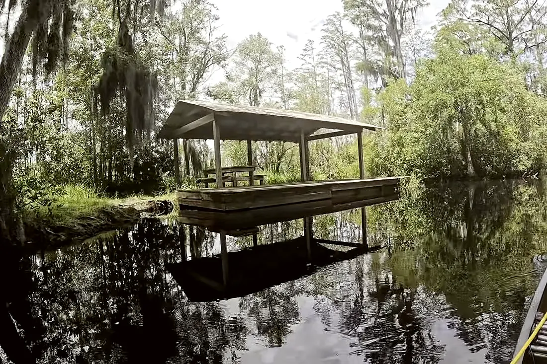
This is Coffee Bay. It's a land-based shelter, six miles from the recreation area.
Orange Trail: Coffee Bay toward Canal Run
Leaving Coffee Bay, you keep following the canal west. Canal Run is four more miles. Fishing is popular along the Suwannee Canal.
Orange Trail: Canal Run
This is Canal Run. It's a land-based platform with a fire ring, ten miles from the recreation area and seven from Okefenokee State Park.
Orange Trail: Canal Run toward Billys Island
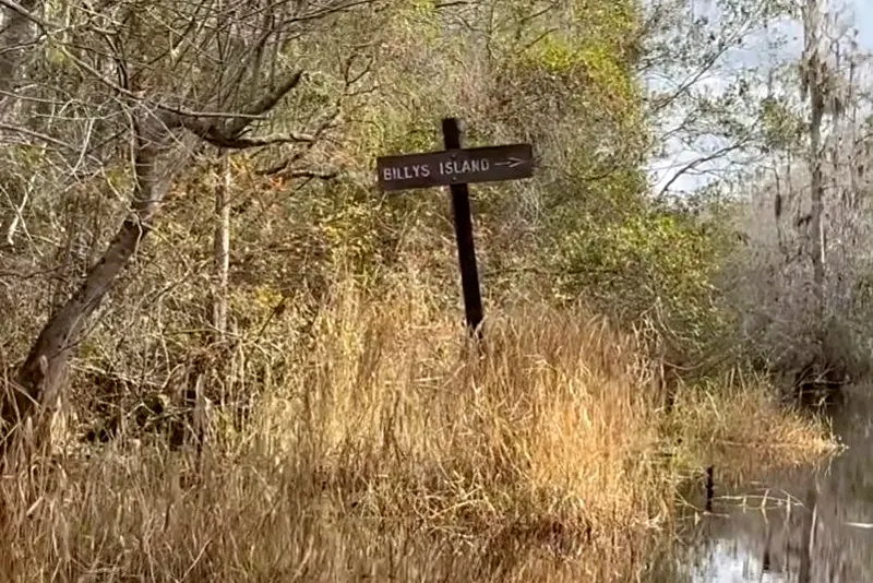
From here the Orange Trail gets harder. It turns narrow and winding for five miles to Billys Island.
Billys Island
This is Billys Island. It's a day-use area, two miles out from Okefenokee State Park. A logging camp here once held six hundred people.
Okefenokee State Park boat basin, Billys Lake
You've come down Billys Lake to the west end of the Orange Trail.
Boat ramp, Suwannee Canal Recreation Area
Hey guys, we got an adventure for y'all today. This is the Pink Trail.
Pink Trail: south into Chesser Prairie
You're leaving the canal and heading south. This is Chesser Prairie.
Pink Trail: Grand Prairie
This is Grand Prairie. The refuge counts it among some of the most iconic open prairie in the swamp.
Pink Trail: Buzzards Roost
This is Buzzards Roost. It's a platform out in Grand Prairie, eight miles from Suwannee Canal Recreation Area.
Purple Trail: the Orange Trail junction near Canal Run
Hey guys, we got an adventure for y'all today. This is the Purple Trail.
Purple Trail: across Chase Prairie
You're out on Chase Prairie now. The work here is the vegetation, which can slow you badly across the prairie.
Purple Trail: Round Top
This is Round Top. It's a platform in Chase Prairie with a three hundred sixty degree view of the swamp.
Purple Trail: the way back to the Blue Trail
From Round Top the Purple Trail goes on and meets the Blue Trail. The Blue Trail is a connector along the edge of Chase Prairie.
Blue Trail: where it leaves the Orange Trail
Hey guys, we got an adventure for y'all today. This is the Blue Trail. It's a connector, and the refuge rates it moderate.
Blue Trail: along the edge of Chase Prairie
The Blue Trail skirts the edge of Chase Prairie. The water here is dark, stained, and slow.
Blue Trail: where it meets the Green Trail
This is where the Blue Trail meets the Green Trail.
Kingfisher Landing boat ramp
Hey guys, we got an adventure for y'all today. You're at Kingfisher Landing, the quietest of the three official entrances.
Green Trail: Kings Canal to the open lakes
You're in Kings Canal now. It was dug for peat mining before this became refuge.
Green Trail: Bluff Lake
This is Bluff Lake. The platform is on the far side, so paddle across the lake to the shelter. It's eight miles from Kingfisher Landing.
Green Trail: Bluff Lake to Floyds Island
Beyond Bluff Lake the Green Trail runs through Territory and Chase Prairies. It's about nine miles to Floyds Island.
Floyds Island camp
This is Floyds Island. It's a real island camp under the trees, with a fire ring. A trail crosses the island east to west past an old hunting cabin.
Green Trail: Floyds Island toward Billys Lake
From Floyds Island the Green Trail runs through marsh and cypress to Billys Lake. It's nine miles to Okefenokee State Park.
Okefenokee State Park boat basin, Billys Lake
You've come to the west end of the Green Trail, at Okefenokee State Park. The boat basin and ramp are here.
Kingfisher Landing boat ramp
Hey guys, we got an adventure for y'all today. You're at Kingfisher Landing. This is the start of the Red Trail, and it's rated difficult.
Red Trail: Kingfisher Landing toward Maul Hammock
You're heading out through scrub-shrub, marsh, and small lakes. It's twelve miles to Maul Hammock.
Red Trail: Maul Hammock
This is Maul Hammock Lake. The platform is on the left edge of the lake. Look behind you as you enter, or you will paddle past it.
Red Trail: Maul Hammock to Big Water
Past Maul Hammock the trail runs through marsh, then a narrow, closed-in channel, then a wider river run to Big Water.
Red Trail: Big Water
This is Big Water. The platform is at the north end of Big Water Lake. There's seasonal fishing, and great night sky, sunrise, and sunset.
Red Trail: Big Water through the cypress toward Minnies Lake
The last miles of the Red Trail run through cypress forest. You'll pass Minnies Lake, then Minnies Run and Billys Lake.
Red Trail: Minnies Lake
This is Minnies Lake. It's a raised deck out in the cypress, and some of the thickest gator water in the refuge.
Okefenokee State Park boat basin, Billys Lake
You've come down through Minnies Run and Billys Lake to the end of the Red Trail.
Okefenokee State Park boat basin
Hey guys, we got an adventure for y'all today. You're at Okefenokee State Park, the west entrance. This is the start of the Brown Trail.
Brown Trail: across Billys Lake to Mixons Hammock
You're paddling across Billys Lake. Turn left at Billys Lake and it's a short paddle to Mixons.
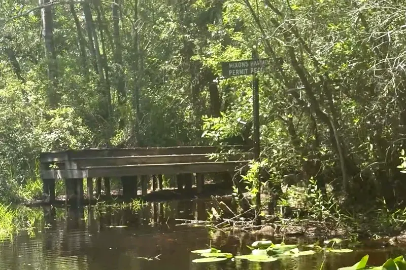
Mixons Hammock
This is Mixons Hammock. It's a land-based platform with a fire ring, two miles from Okefenokee State Park.
Brown Trail: through the River Narrows
From Mixons the Brown Trail goes through the River Narrows. It's moderate here.
Suwannee River Sill
This is the Suwannee River Sill. It's the earthen dam at the head of the Suwannee, and it is not an official refuge entrance.